|
|
Post by Diane Merkel on Mar 23, 2009 16:32:28 GMT -6
From a website visitor: Do you have any information that would pinpoint the exact location of the East River Post Office from about 1860?
I have located relatives who were enumerated there in the 1860 census and believe they were living on the shores of Shoal River in what is now Okaloosa County. Is it possible that East River post office was at the present location of Deerland?
It makes sense to me that any post office would have been located along the Old Spanish Trail since this timeframe largely precedes the development of Crestview and De Funiak Springs.
Any information or leads would be greatly appreciated. I found a nice collection of maps at fcit.usf.edu/florida/maps/galleries/County/Walton/index.phpThe last one to show East River P.O. was in 1882. East River appears to be a distance from the railroad (look above the "N" in PeNsacola & Atlantic RR"). 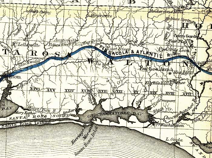 By 1886, Deerland is shown, but it appears to be on the railroad line. 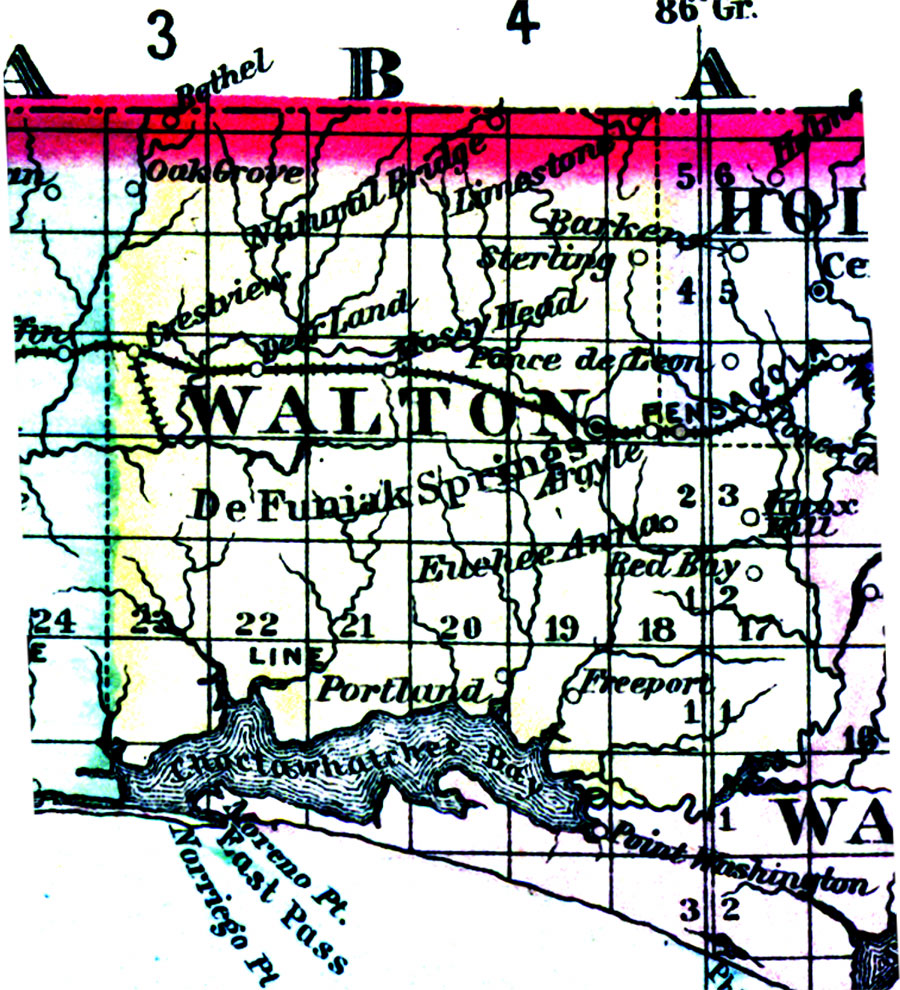 Any and all help will be appreciated! Diane HD#16 |
|
|
|
Post by Diane Merkel on Mar 27, 2009 20:53:04 GMT -6
Poverty Creek Jim offered this: A map in my possession titled: Map of Florida, published by Columbus Drew Bookseller, Jacksonville, Fla (undated) obtained from the records of the National Archives and Records Administration shows the "East River P.O." The location of the P.O. is placed south of the Shoal River. The scale of the map is so small that it is difficult to place the P.O. exactly but the location is consistant with being in the general area of Deerland, possibly a bit to the west of Deerland. However the P.O. was located near the junction of a creek which might be Poverty Creek at its junction with the Shoal River. The map is so early that neither Crestview nor Laurel Hill were in existance at the time the map was published. Almirante is shown as being one range to the west and three townships to the north. For the moment that is all the Poverty Creek Peddler has to offer. Thank you, Jim! |
|

